Flytomap All in One HD Charts 6.5.8
Paid Version
Publisher Description
FlyToMap™ is a valid and interesting alternative, Benetti Yachts
► The charts downloaded are resident in the app. No internet connection required!
Flytomap All In One HD works on all Apple devices
FlyToMap™ offers a revolutionary app; you can download any chart worldwide (500+) free of charge
Check out your area on viewer.flytomap.com
- All USA Marine charts (US All, East, West, Great Lakes, Major Rivers, Florida, Texas, California, etc.)
- USA Lake Maps 15000+ : Minnesota, Maine, Michigan, Massachusetts, Wisconsin, Texas, California, Florida, Iowa, North and South Dakota...and many more.
- 150+ USA Parks and Forests
- Australia Marine Charts
- Australia Parks
- New Zealand Marine charts
- All Europe Marine Charts
- 200+ major EU Parks
- The world's most famous holiday destinations ie: Caribbean, Seychelles, Mauritius, Maldives, Canary Islands, Azores, Bora Bora, Bali, Oslo Fjord .. and many more.
- Canada Lake Maps: Alberta, Lake of the Wood.. and many more.
► Worldwide Marine and Outdoor Maps available, thanks to viewer.flytomap.com
► Worldwide Satellite images overlay on charts
► Worldwide Terrain features overlay on charts, thanks to Open Street Map, Open Cycle Map, Bing, Earth, GMap
► Interactive Weather forecast
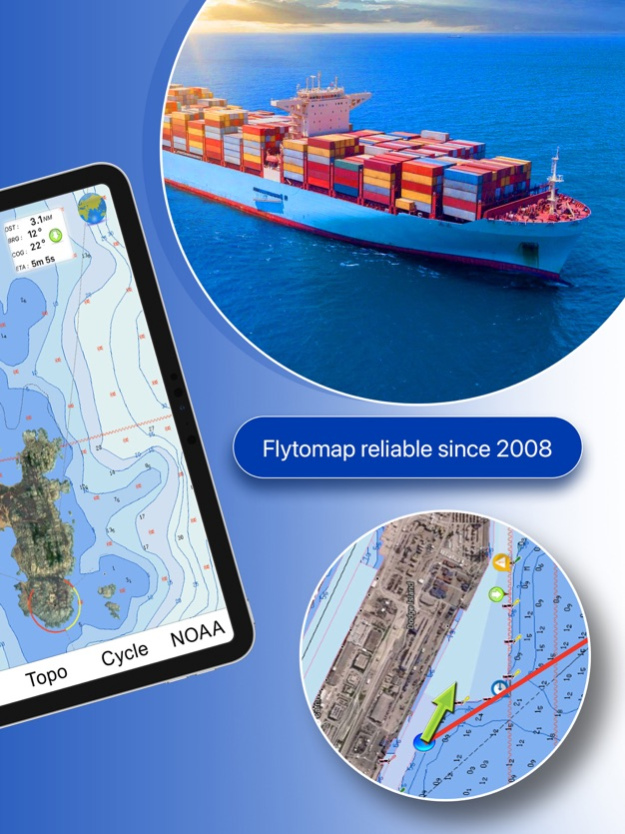
► NOAA raster charts seamless with continuous updates from the official Government server
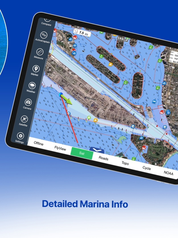
► ActiveCaptain - Worldwide boaters community, with 200.000 + Captains
Use to Explore:
√ Latitudes and Longitudes to go to your favorite places
√ Search your Favorite points directly
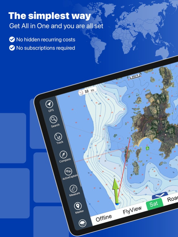
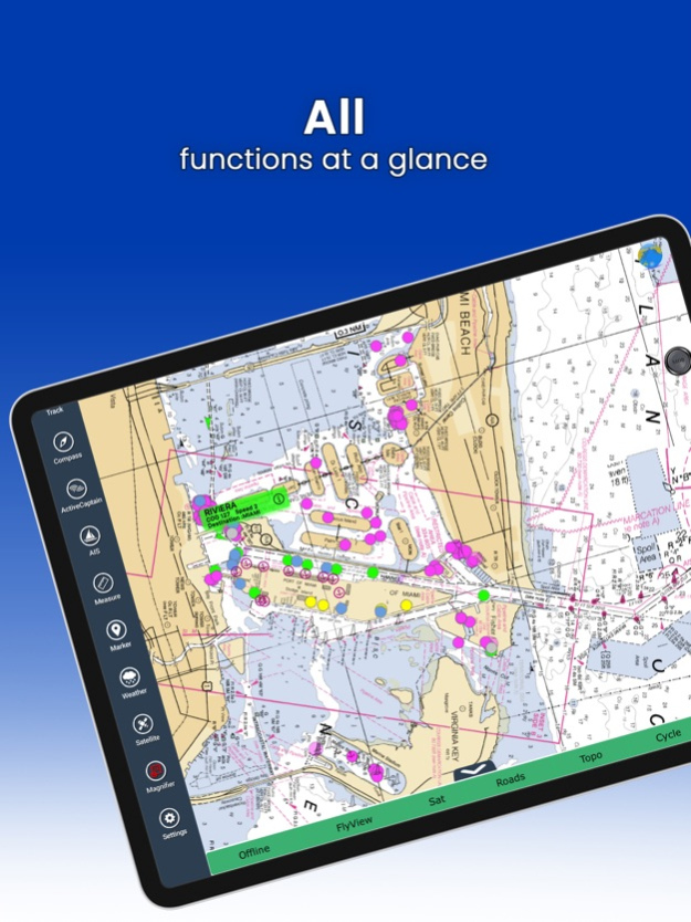
√ Zoom, Rotate and Pan fast just by a finger touch
√ Quick Object information just tapping, thanks to vector technology
√ GPS Heading Vector Towards the direction movement
√ Distance Measurement Tool to easily calculate the distance from one location to another
√ Route planning, unlimited Waypoints - Insert the target/destination and see in real time your speed, distance and bearing
√ Magnified Lens for all info
√ Unlimited Tracks, Markers, Geo-tagged photos, records and share via email, visible on Google, Flytomap Viewer, KMZ format - Store your track without the need of cellular data or mobile signal
√ Select Depth Contours
√ a la carte menu
√ iOS background mode - Flytomap works in background as well, you can swap with another app and receive/make calls send sms while track recording.
√ Optimized battery usage
√ And so much more to come - It’s the only app you will ever need! Our charts are installed on: NAVICO LOWRANCE B&G NORTHSTAR EAGLE SIMRAD
Follow us:
▶ Twitter @flytomap
▶ Web Site flytomap.com
▶ Facebook facebook.com/flytomap
FlytoMap™ has a wide range of Applications and Maps for you to use - Free of charge on Flytomap All In One !
- WATER MAPS
Electronic Nautical Charts with the same accuracy and detail as on your chart plotter. Maps include Coastline, Anchoring areas, Fishing areas, Restriction areas, Obstructions, Rocks, Buoys, Beacons, Lights, Depth contours, Spot Soundings and more.
- LAKE MAPS
High quality lake maps with detailed information: Depth Contours, Boat Ramps, Fishing spots etc. Maps also include Trails, Roads and Railways information.
- PARK MAPS:
Extremely advanced electronic charts with information collected from National/State Park and Forest Services and many other local sources. The maps contain trails (Hiking, Biking, Equestrian trails etc.,) and Points of interest (POI) like Campgrounds, Visitor Centers, Lookout points, Eating places, Ranger Stations, Picnic areas, Boat/Canoe ramps, Parking areas etc..
- TRAVEL MAPS
These Maps cover the most interesting touristic areas combining Sea and Land information to allow you a complete travel experience.
Feb 17, 2023
Version 6.5.8
Charts added:
Albemarle Sound
Apalachee Bay
Bar Harbour
Baton Rouge
Black Bay Houma
Cape Elizabeth to Cape Ann
Central California
Columbia River
Fiji
Florida South West
Georges Bank
Houston
Juan de Fuca Strait
Laguna Madre
Lake Superior West
Long Island South NY
Massachusetts Bay
Oahu-Kauai
Rhode Island Sound
San Juan Island
Upper Chesapeake
About Flytomap All in One HD Charts
Flytomap All in One HD Charts is a paid app for iOS published in the Recreation list of apps, part of Home & Hobby.
The company that develops Flytomap All in One HD Charts is Flytomap. The latest version released by its developer is 6.5.8.
To install Flytomap All in One HD Charts on your iOS device, just click the green Continue To App button above to start the installation process. The app is listed on our website since 2023-02-17 and was downloaded 39 times. We have already checked if the download link is safe, however for your own protection we recommend that you scan the downloaded app with your antivirus. Your antivirus may detect the Flytomap All in One HD Charts as malware if the download link is broken.
How to install Flytomap All in One HD Charts on your iOS device:
- Click on the Continue To App button on our website. This will redirect you to the App Store.
- Once the Flytomap All in One HD Charts is shown in the iTunes listing of your iOS device, you can start its download and installation. Tap on the GET button to the right of the app to start downloading it.
- If you are not logged-in the iOS appstore app, you'll be prompted for your your Apple ID and/or password.
- After Flytomap All in One HD Charts is downloaded, you'll see an INSTALL button to the right. Tap on it to start the actual installation of the iOS app.
- Once installation is finished you can tap on the OPEN button to start it. Its icon will also be added to your device home screen.
